Google
 

Wednesday, October 3, 2007

ESA : A new milestone in the GMES Space Component Programme successfully achieved

GMES


28 September 2007
ESA PR 30-2007. Yesterday ESA’s Member States participating in the GMES Programme approved the transition to Phase-2 of Segment 1 of the GMES Space Component Programme.

Oversubscription of the programme by the ESA Council at ministerial level in 2005 was confirmed, with oversubscription to phase 2 of 116%, giving a total amount of €500 million. This additional contribution to the programme will allow ESA to confirm the development of the first three Sentinel satellites.

Moreover, some countries, which were unable to confirm their contributions in time, are expected to subscribe later. The GMES Space Component Programme is co-funded by the European Commission.

Mr Volker Liebig, Director of Earth Observation Programmes, says that, "With GMES, Europe will have a global environmental information system in place which will be unique in the world. Europeans can be proud of that fact. Indeed, other nations give GMES as an example of how operational Earth-observing systems can be used to provide critical information to decision-makers and citizens."


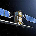
Sentinel-1 artist's impression
ESA, which is responsible for the management and coordination of the overall GMES Space Component in Europe, will, as a result of this transition to Phase-2, be able to make progress on development of the Sentinel satellite series and, in particular, build Sentinel-1, -2 and -3, together with the necessary ground segment.

Prior to launch of the ESA-built Sentinels, which is planned for 2011-12, ESA will coordinate the provision of EO data required by the GMES services currently implemented by the EC. This will help to gradually take GMES from the pre-operational phase to the fully operational stage once the Sentinel satellites are in place.

GMES (Global Monitoring for Environment and Security) is an EU-led initiative aimed at implementing information services dealing with environment and security.

ESA : Earth from Space: Ice-free Foxe Basin

Foxe Basin, Canada

28 September 2007
This Envisat image highlights an ice-free Foxe Basin – a nearly circular shallow extension of the Atlantic Ocean – located in the Canadian territory of Nunavut.

Foxe Basin remains ice-covered for most of the year, with landfast ice (sea ice that remains attached to the coast) dominating in the north and pack ice (normally broken separate blocs of ice) covering the deeper southern waters. The Basin’s depth varies between 100 m and 400 m.

Located north of Hudson Bay between the Melville Peninsula (visible on the left) and the large Baffin Island (visible stretching from top left corner across top of image down to lower right corner), Foxe Basin connects with Hudson Bay (not visible but located to the south) and Hudson Strait (located beneath Baffin Island) via the 320-km long Foxe Channel. Baffin Island covers an area of some 507 451 sq km, making it the largest island in Canada and the fifth largest in the world.

The Basin is named after Luke Foxe, who explored the area in the seventeenth century in the hope of finding a Northwest Passage across North America. Because of its shallow and typically icebound waters, it does not form part of the passage.

Stretching roughly 500 km across at its widest point, the Basin is home to the last large landmasses discovered in North America. Prince Charles Island (the large round island in the centre of the image), Air Force Island (located to the east of Prince Charles) and Foley Island (located off Prince Charles’ northern tip) were all discovered in 1948 from aerial surveys.

This area is one of the most biologically rich and diverse areas of the Canadian Arctic, supporting colonies of bearded seals and the largest walrus herd in Canada. It is a summering area for bowhead, beluga and narwhal whales.

This image was acquired by Envisat's Medium Resolution Imaging Spectrometer (MERIS) instrument on 23 September 2007, working in Full Resolution mode to provide a spatial resolution of 300 metres.