| Find the entire Hubble News archive, image galleries, and much more at hubblesite.org | Thousands of sparkling young stars are nestled within the giant nebula NGC 3603. This stellar "jewel box" is one of the most massive young star clusters in the Milky Way Galaxy. NGC 3603 is a prominent star-forming region in the Carina spiral arm of the Milky Way, about 20,000 light-years away. This latest image from NASA's Hubble Space Telescope shows a young star cluster surrounded by a vast region of dust and gas. The image reveals stages in the life cycle of stars. |
Tuesday, October 2, 2007
Hubblesite: Star Cluster Bursts into Life in New Hubble Image

ESA : ANITA air quality monitor operational on International Space Station
1 October 2007 The Analysing Interferometer for Ambient Air (ANITA) flight experiment, an ESA developed technology demonstrator for monitoring the quality of the air inside manned space vehicles, is now in operation on the ISS. The Space Shuttle Endeavour carried ANITA to the ISS in the SpaceHab Module during flight STS 118 (ISS mission 13A.1) which was launched on 9 August 2007. ANITA has been installed in EXPRESS
| ||||||||
| ||||||||
The air quality of any manned spacecraft needs to be continuously monitored in order to safeguard the health of the crew. In space the astronauts have to respond rapidly to any accidental release of harmful gaseous contaminants or degradation of the environmental control and life support system. Air quality monitoring grows in importance as mission duration increases. ANITA is designed to monitor the cabin air for contaminants at concentrations down to the low parts per million (ppm) or high parts per billion (ppb), with high precision. Its fast measurement cycle allows the trend in air quality to be analysed in near real-time. In normal operational mode, ANITA automatically monitors the local air by filling its gas cell, measuring the sample and storing the analysis data. The gas cell is then flushed back into the cabin and refilled for the next measurement cycle, each of which takes six minutes. This process is possible since the air sample is physically and chemically unchanged by the measurement. If so desired, the crew can also collect air samples at remote locations using a hand pump and sample bags. The sample bags are then manually connected to ANITA’s gas inlet port for analysis. | ||||||||
ANITA is an ESA-NASA cooperative programme. The flight experiment has been developed under ESA contract by Kayser-Threde GmbH (Germany), the instrument Prime Contractor and hardware developer, and SINTEF (Norway), responsible for the gas analysis software and instrument calibration. For further information concerning scientific and technical matters, contact Gijsbert Tan, Life Support and Environmental Control Section, ESA-ESTEC. | ||||||||


ESA : ESA trains next generation of Earth Observation scientists
| |||
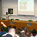
Raging fires in Spain and Portugal |

More than 60 students from 18 European countries gathered at the Universidade Nova de Lisboa in Portugal to attend a six-day advanced training course devoted to exploiting ESA Earth Observation remote sensing data for land applications, such as forestry, fires, floods and water availability.
The course introduced students to remote sensing applications and illustrated the use of specific software tools for exploiting Earth Observation (EO) data from ESA’s ERS and Envisat satellites, Third Party Mission (TPM) satellites and the Explorer satellites.
"This type of training encourages the use and exploration of European information and technology and is important because it is part of the foundation of the training of the future leading European investigators in remote sensing," Marco Painho, Director of the Institute of Statistics and Information Management at Universidade Nova de Lisboa, said.
| |||
The main applications of land remote sensing, which were addressed through keynote lectures and dedicated hands-on sessions, included land cover and land use classification techniques, forest and crop mapping, forest fire detection and drought monitoring. Advanced techniques such as SAR Interferometry, used for detecting very slight volcanic or tectonic land motion, and SAR Polarimetry, employed to add multi-polarised 'colour' to radar images for enhanced land-cover mapping, were also covered.
"The school made me realise the techniques of EO offer many different possibilities of application. For me it was a demonstration of how we can use the accessible data and tools and how we can build our research activities to make full use of this potential," Agnieszka Izykowska, a student from Polish Space Research Centre, said.
| |||

"There are a lot of types of software available for processing EO data, but most of these are quite expensive and do not have the tools for adequate information extraction," Prof Mario Caetano said. "This is why I want to acknowledge all the effort ESA has put in the development of software tools for processing EO data, in particular radar data. All these ESA developed software tools are publicly available, free of costs, and I am sure that such a policy will largely increase the research on land remote sensing."
| |||
Group picture |
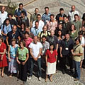
Upon completion of the training, the students received two European Credit Transfer and Accumulation System (ECTS) credits by Universidade Nova de Lisboa. ECTS is the basis for comparing the competence and performance of students of higher education across the European Union and other collaborating European countries.
ESA is planning a first advanced training course in atmosphere remote-sensing to be held at University of Oxford, UK, from 15 to 20 September 2008.
| |||
Radar image of Lisbon |

The Advanced Synthetic Aperture Radar (ASAR) is an imaging radar operating at C-band and capable of observing the Earth's surface day and night, independently of cloud conditions. It features a selectable range of incidence angles, polarisation and modes of operation at different spatial resolution and swath widths.
The Medium Resolution Imaging Spectrometer (MERIS) is an imaging spectrometer that measures the solar radiation reflected by the Earth at a ground spatial resolution of 300 m. It operates in 15 spectral bands in visible and near infra-red and is programmable in width and position. MERIS allows global coverage of the Earth every 3 days.
The Advanced Along Track Scanning Radiometer (AATSR) is an imaging multi-spectral radiometer working in the visible and infra-red spectral domains. It is the most recent in a series of instruments designed primarily to measure Sea Surface Temperature (SST). AATSR data can also be used for a number of land surface, cryosphere and atmospheric applications. AATSR data have a resolution of 1 km at nadir.
Space.com : Mars in the Morning: Red Planet Grows Brighter
 | By Joe Rao SPACE.com Skywatching Columnist posted: 28 September 2007 06:51 am ET |
Mars is coming!
You've probably heard that line before – no doubt fairly recently, thanks to a bogus e-mail that unfortunately received wide circulation on the Internet this summer with promises of Mars being as big as the full moon.
But this fact is absolutely true: Mars, the only planet whose surface we can see in any detail from the Earth, is now moving toward the best viewing position it will provide to us until the year 2014. Planet watchers have already begun readying their telescopes.
If you haven't seen it, it will be well worth looking for the red planet next week, even though you'll have to wait until after midnight to see it well.
Mars is currently midway between the zodiacal constellations of Taurus, the Bull and Gemini, the Twins and during this week it will rise shortly before 11 p.m. local daylight time. There is certainly no mistaking it once it comes up over the east-northeast horizon. Presently shining like a pumpkin-hued, zero magnitude star, Mars is currently tied for fifth place (with Vega) among the 21 brightest stars.
But as it continues to approach our Earth in the coming weeks and months, Mars will only be getting brighter: it will surpass Sirius, the brightest star in the sky by Dec. 9 and during the latter half of December it will even almost match Jupiter in brilliance.
Late next Wednesday night (or more precisely, early on Thursday morning), Mars will hover about 7-degrees above and to the right of the last quarter moon as they rise above the east-northeast horizon (your clenched fist held at arm's length is roughly 10-degrees in width). As you will see for yourself, the so-called "Red Planet" actually will appear closer to a yellow-orange tint – the same color of a dry desert under a high sun.
How close?
Every 26 months, or so, Earth makes a close approach to Mars, as our smaller, swifter orbit "overtakes" Mars around the sun. Because both the orbits of Mars and Earth are mildly elliptical, some close approaches between the two planets are closer than others.
This current apparition of Mars will be nowhere near as spectacular as the oft-referred approach of August 2003 when the planet came closer to Earth than it had in nearly 60,000-years.
Rather, on this upcoming occasion, Mars will come closest to Earth on the evening of December 18th (at around 6:46 p.m. Eastern Standard Time).
The planet will then lie 54.8 million miles (88.2 million kilometers) from Earth as measured from center to center. Mars will arrive at opposition to the sun (rising at sunset, setting at sunrise) six days later on Christmas Eve, December 24th.
How big?
That recent Martian e-mail message – a hyperbole which was widely circulated for a fourth consecutive year – lead people to believe, with liberal use of exclamation marks, that on Aug. 27, Mars would appear as bright as (or as large as) that night's full moon in the night sky. The subject header urged viewers to prepare to view "Two Full Moons."
It was amazing (and a little disturbing) to see just how many people actually believed that Mars could loom so large in our sky. But the truth is that even when at its absolute closest possible approach to Earth, Mars can appear no larger than 1/72 as big as the moon; to the unaided eye it would appear as nothing more than an extremely bright, non-twinkling star.
When it comes closest to Earth on December 18th of this year, Mars' apparent disk diameter will be equal to 15.9 arc seconds. To get an idea of just how large this is, wait until darkness falls this week and if you have a telescope, check out Jupiter, gleaming in the southwestern sky; it'll appear about 35 arc seconds across.
In contrast, Mars' disk will appear less than half as big as Jupiter's when the Red Planet comes closest to Earth later this year. While this may sound small, keep in mind that this is still atypically large for Mars. In fact, from November 30th through Jan. 5, 2008, Mars' apparent size will be larger than at any time until April 2014. Around the time that Mars is closest, amateurs with telescopes as small as 4-inches and magnifying above 120-power should be able to make out some dusky markings on the small yellow-orange disk, and perhaps the bright white polar cap.
Size isn't everything
From Dec. 15 through Dec. 29, Mars will blaze at magnitude -1.6, a bit brighter than Sirius, but just slightly inferior to Jupiter. Mars will still be positioned between Taurus and Gemini, at a rather high declination of about +27-degrees.
So almost as if to compensate for its relatively small apparent size, Mars will literally soar in the night sky of late-December.
When it reaches its highest point in the sky at around midnight local time, its altitude will be 70-degrees at Seattle, 76-degrees for New York, and an exceptional 83-degrees at Los Angeles. Meanwhile, amateur and professional astronomers stationed in southern Texas and central Florida will see Mars pass directly, or very nearly overhead!
Joe Rao serves as an instructor and guest lecturer at New York's Hayden Planetarium. He writes about astronomy for The New York Times and other publications, and he is also an on-camera meteorologist for News 12 Westchester, New York.
Space.com : Pluto-Sized Planet Embryos Detected
 | By Ker Than Staff Writer posted: 01 October 2007 06:35 am ET |
Puffy debris disks around three nearby stars could harbor Pluto-sized planets-to-be, a new computer model suggests.
The "planet embryos" are predicted to orbit three young, nearby stars, located within about 60 light years or less of our solar system. AU Microscopii (AU Mic) and Beta Pictoris (Beta Pic) are both estimated to be about 12 million years old, while a third star, Fomalhaut, is aged at 200 million years old.
If confirmed, the objects would represent the first evidence of a never-before-observed stage of early planet formation. Another team recently spotted "space lint" around a nearby star that pointed to an even earlier phase of planet building, when baseball-sized clumps of interstellar dust grains are colliding together.
The new finding will be detailed in an upcoming issue of the Monthly Notices of the Royal Astronomical Society.
Planet puffer-uppers
Using NASA's Hubble Space Telescope, the researchers measured the vertical thickness of so-called circumstellar debris disks around the stars, and then used a computer model to calculate the size of planets growing within them.
The thickness of a debris disk depends on the size of objects orbiting inside it. The ring of dust thins as the star system ages, but if enough dust has clumped together to form an embryonic planet, it knocks the other dust grains into eccentric orbits. Over time, this can puff up what was a razor-thin disk.
The new model the researchers created predicts how large the bodies in a disk must be to puff it up to a certain thickness. The results suggest that each of the three stars studied is harboring a Pluto-sized embryonic planet.
"Even though [the disks] are pretty thin, they turn out to be thick enough that we think there's something in there puffing them up," said study team member Alice Quillen of the University of Rochester in New York.
At least one of the stars is thought to contain at least one other planet in addition to the circling Pluto-sized planet. The circumstellar disk of Fomalhaut contains a void that scientists think is being cleared out by a Neptune-sized world. The researchers think the embryonic planets predicted by their model are too small to clear gaps like this in the disk.
"If you think of water flowing over pebbles, if the pebbles are very small at the bottom of the water, it doesn't make a good ripple," Quillen told SPACE.com.
Too far?
All of the embryonic planets predicted to exist in the three systems are located far away from their parent stars. Au Mic's budding planet is estimated to lie about 30 AU from its star, or about the same distance that Pluto is from our sun. One AU is equal to the distance between Earth and the sun. The embryonic planets of Beta Pic and Fomalhaut are thought to lie even farther, at 100 and 133 AU, respectively.
It is the large distances separating the planet embryos and their stars that have drawn the most criticism by colleagues, Quillen said. Many find it hard to believe that any planet, even a diminutive Pluto-sized one, could form at such a far distance.
According to the standard theory of how our solar system formed, Pluto formed much closer to the sun but was then knocked out to its current orbit due to instability in the inner solar system. However, there are objects in our solar system that are located even further from our sun and are difficult to explain by this theory. Sedna, for example, is about three-fourths the size of Pluto and is located about three times farther from the sun.
Mordecai-Marc Mac Low, an astrophysicist at the American Museum of Natural History in New York City who was not involved in the study, said the new model should be viewed as a plausibility argument for the presence of Pluto-sized objects rather than proof of their existence.
"The work presented here shows that Pluto-sized objects stirring disks are consistent with the observed disk thicknesses and other properties," Mac Low said.
James Graham, an astronomer at the University of California, Berkeley, who was also not involved in the study, expressed a similar sentiment. "This calculation is making a bold extrapolation," Graham said in an email interview. "It's bit like describing an elephant given a single cell from that animal. With enough knowledge, this is possible—if you know enough about microbiology and genetics and could read the DNA in the cell and in principle envision the entire creature."
Quillen is now looking for more young stars to investigate with her model, but the criteria to be a candidate are strict. The systems have to be young enough to still have their circumstellar disks, but old enough to be forming embryonic planets. They must also appear edge-on as seen from Earth and be near enough that Hubble can accurately discern the thickness of their disks.
At the moment, the three stars Quillen has already observed appear to be the only candidates that meet all the standards.
Space.com : High-Definition Imagery of Earth Shot from Space
 | By Jeanna Bryner Staff Writer posted: 01 October 2007 11:41 am ET |
The first high-definition video of Earth from beyond the planet's orbit has just been made by a Japanese satellite on its way to the moon.
The imagery was taken by the lunar explorer Kaguya, launched by the Japan Aerospace Exploration Agency (JAXA) on Sept. 14 (Japan Standard Time). The onboard high-definition television, developed by the Japan Broadcasting Corporation, captured the eight-minute video about 68,350 miles (110,000 kilometers) away from Earth.
The video has not been released, but in a still shot taken from the footage, the west coast of South America is seen, awash in daylight.
Kaguya is Japan's first lunar explorer. It is also known as SELENE (Selenological and Engineering Explorer) and is the largest lunar mission since the Apollo program. Kaguya will investigate the entire moon in order to determine its chemical composition, surface and subsurface structure, the remnants of its magnetic field and its gravity field.
The results are expected to lead to a better understanding of the moon's origin and evolution. In addition, the onboard observation equipment will shed light on the electromagnetic field and high-energy particles that humans potentially would be exposed to during human space missions.
The video was taken Sept. 29 Japan time and received at the JAXA Usuda Deep Space Center on Sept. 30.
ESA : Successful test of Jules Verne ATV software
| |||
ATV software was integrated into the whole ISS software ground testbed |

For the first time, the compatibility of the final Jules Verne Automatic Transfer Vehicle flight software has been successfully tested this month with the rest of the vast ISS flight software by international teams at the NASA Software Verification Facility (SVF) in Houston.
This ISS-level stage test, the so-called ’five-box’ test, is a new step where the ATV software is integrated into the whole ISS software ground testbed. It was conducted for 12 days over three weeks by some 43 engineers from NASA, ESA, Astrium, RSC-Energia and Boeing at the SVF Software Development and Integration Laboratory (SDIL), a few miles from NASA's Johnson Space Center. Another 30 people behind the scenes also provided support on site, in Russia and Europe.
For the ATV it is a trilateral test with the Russians playing a key role, as the Jules Verne re-supply spaceship will dock with the Russian Service Module. "The ATV Stage Integration Test was very successful and surpassed all of our expectations. This test demonstrated the integrated flight software functionality across the US segment, the Russian segment, and the ESA ATV vehicle for the timeframe in which the ATV is docked to the ISS. This success is the result of years of hard work and demonstrates the tremendous commitment of all three international partners, working together toward a common objective," said Susan Creasy, NASA ISS Avionics and Software Office Manager.
| |||
NASA's Sonny Carter Training Facility in Houston |

Test and verification of all ISS flight software is done at the SDIL, a world class infrastructure which houses over 800 computers. Its purpose is to provide a full confidence in the safety and efficiency between the different elements of the ISS for mission-critical software.
The Jules Verne ATV, which is scheduled to be launched in early 2008, is known as the ‘fifth box’, in this five-box test, which includes the two Fault Tolerant Computers (FTCs) of the Russian Service Module, the two MDM computers of the US Destiny Lab and for the first time, the ATV. Similar testing is required for ESA’s Columbus module and the Japanese Kibo module. On board the ATV, the FTC, which is the main 3-unit computer, and its flight application software play the role of a pilot that navigates the ATV mission.
| |||
The safety of the 220-tonne orbital outpost depends on smooth communication across the software |

The complexity of the different software and their compatibility will play a crucial role during the attached phases such as the re-boost operation, the debris avoidance manoeuvres and the desaturation of the Space Station’s gyroscopic attitude system while the ATV is attached to the ISS. The safety of the whole 220-tonne orbital outpost depends on smooth communication across the module software of the different partners. The flight code on the US side and the Russian side contains over four million lines of code and there are about one million lines of code in the various computers of the ATV spaceship.
| |||
Inside the Software Development and Integration Laboratory facility |

For those dedicated tests in the SVF, key elements of the real flight hardware, such as the ATV FTC, are connected to a high fidelity ATV simulator which reproduces the different scenarios and behaviour of the European spaceship, and a replica of the onboard data management system. Thanks to this complex infrastructure, with its interconnecting flight hardware, powerful computers and numerous pieces of software and synchronised simulation systems from all partners, it is as if the avionics bay of the ATV is actually flying in orbit with the rest of the ISS.
The facility in Houston will be continuously available to simulate on the ground, with the ATV software, any orbital scenarios of the five ATV missions planned between 2008 and 2015.
Notes for editors
Jules Verne is the first of a series of ATVs which will bring supplies including food, water, and fuel as well as experiment equipment to the crew on board the International Space Station. A crucial element of the ISS programme, the ATV will also re-boost the Station’s orbit to overcome the effects of residual atmospheric drag. After six months the ATV will undock and be used to dispose of Station waste during a guided and controlled destructive re-entry into the atmosphere high over the Pacific Ocean.
NASA : The Sun Rips Off a Comet's Tail
October 1, 2007: Comet Encke never knew what hit it.
On April 20, 2007, the comet had just dipped inside the orbit of Mercury, perilously close to the sun, when a solar eruption struck and literally tore the comet's tail off. This surely has happened to comets before, but for the first time in history a spacecraft was watching. NASA's STEREO-A probe recorded a fantastic movie of the collision. To play it, click on the image:

Above: A CME strikes Comet Encke. Click to play: 7 MB avi, 4 MB gif
"We were speechless when we saw this," says Angelos Vourlidas of the Naval Research Lab in Washington, D.C. "I kept playing the movie over and over."
Vourlidas is part of a team of NRC researchers who built the Heliospheric Imager telescope onboard STEREO-A that recorded the event. He's also the lead author of a paper reporting the collision in the Oct. 10 issue of the Astrophysical Journal Letters.
The eruption that hit Encke was a CME or "coronal mass ejection." Sky watchers on Earth are familiar with CMEs because of the auroras they create when they occasionally hit our planet. CMEs are fast-moving and massive, packing billions of tons of solar gas and magnetism into billowing clouds traveling a million-plus miles per hour.
Actually, it is a little surprising that a CME succeeded in ripping off a comet's tail. For all their mass and power, CMEs are spread over a large volume of space. The impact of a gossamer CME exerts little more than a few nanoPascals of mechanical pressure—softer than a baby's breath.The ripping action must have been something else.
"We believe the explanation is 'magnetic reconnection,'" says Vourlidas. Magnetic fields around the comet bumped into oppositely directed magnetic fields in the CME. Suddenly, these fields linked together--they "reconnected"--releasing a burst of energy that tore off the comet's tail. A similar process takes place in Earth's magnetosphere during geomagnetic storms powering, among other things, the aurora borealis.
"In a sense, the comet experienced a geomagnetic storm," says Vourlidas. "It is the first time we've ever witnessed such an event on another cosmic body."
"Although STEREO is primarily designed to study CMEs and their impact on Earth, we hope this CME strike on Encke will provide insights to scientists studying comets as well," adds Mike Kaiser, STEREO project Scientist at NASA's Goddard Space Flight Center.
 Right: STEREO-A monitors a solar eruption, an artist's concept. [More] [Larger image]
Among astronomers, Encke is one of the most famous and important comets. It was only the second comet named, after Halley itself, and it is the shortest-period comet known. Encke loops around the sun once every 3.3 years compared to, say, once every 75 years for the more typical Halley.
Encke's short period combined with its trajectory inside the orbit of Mercury means it may have been blasted by CMEs more often than any other comet routinely observed by astronomers. Could this have some effect on the comet's nature and evolution? "We don't yet know."
Vourlidas' team is only beginning to study all the data gathered by STEREO. The spacecraft carries a suite of five different telescopes (collectively known as SECCHI) each optimized for a different kind of observation ranging from wide-angle views of CMEs at visible wavelengths to pinpoint maps of sunspots through high-resolution ultraviolet filters. The Heliospheric Imager movie represents just a fraction of the total dataset. In the months ahead, "we're going to be looking at the CME-comet interaction in much greater detail to understand the processes at work," says Vourlidas.
Encke may not know what hit it, but NASA scientists soon will.
NASA : Education material
The Educational Materials section of NASA's Web site offers classroom activities, educator guides, posters and other types of resources that are available for use in the classroom. Materials are listed by type, grade level and subject. The following items are now available for downloading.
The Kepler Mission Star Field Lithograph
The Kepler Mission Star Field Lithograph is now available in the Lithographs section of the Educational Materials area.
This lithograph features an image of the star field that the Kepler spacecraft will observe during its four-year mission. The back provides information about the star field.
Download the Kepler Mission Star Field Lithograph from the following location:
What is Your Cosmic Connection to the Elements? Poster and Activity Booklet
The What is Your Cosmic Connection to the Elements? Poster and Activity Booklet are now available in the Educational Materials area.
This poster and activity booklet provide information and classroom activities on topics in astronomy, physics and chemistry. Chemistry teachers will find information about the cosmic origin of the chemical elements. The astronomy topics include the big bang, life cycles of small and large stars, supernovae, and cosmic rays. Physics teachers will find information on fusion processes, and physical principles important in stellar evolution.
Download the What is Your Cosmic Connection to the Elements? poster from the following location:
Download the What is Your Cosmic Connection to the Elements? Activity booklet from the following location:
Strategic Coordination Framework: A Portfolio Approach Brochure
The Strategic Coordination Framework: A Portfolio Approach brochure is now available in the Program Brochures section of the Educational Materials area.
The NASA Education Strategic Coordination Framework aligns NASA’s total education portfolio with its Strategic Plan; provides a coordination structure; and creates an agency-wide strategic planning, implementation and evaluation framework for NASA’s investments in education. The plan encompasses all education efforts undertaken by NASA and guides the agency’s relationships with external education partners, including Minority Serving Institutions, professional associations, universities, school systems, industry and other federal agencies.
Download the Strategic Coordination Framework: A Portfolio Approach brochure from the following location:
http://www.nasa.gov/audience
Subscribe to:
Posts (Atom)

